Gpx File
Advertisement
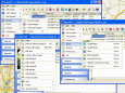
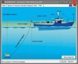
DRAGSENS v.4.01
DRAGSENS Geo Software is used for the exact position estimation of a towed body, sensor, camera, array or net, dragged behind a ship, aircraft or vehicle. The software allows a real-time estimation of the position of a dragged sensor.
Advertisement
KML2KML v.3.0.12
KML2KML is an application including tools for reorganization and optimization of your kml/kmz data.
ShowGPS v.2.83
ShowGPS can GPS analysis, POI management, measurements, statistics, map view, tracking, sound and voice output. ShowGPS = GPS + POI + Map + Tracking.The GPS/POI/Map/Tracking tool for PC. An extension of your navigation software.
QMapExplorer v.Beta 1
View and explore maps with this tool. QMapExplorer is an software to access, view and explore tile based online maps like OpenStreetMap or GoogleMaps. This is the first beta release with serious functionality.QMapExplorer Features: 1. High precision
Bluewater Racing Lite v.1.52
Plan your sailboat races using this convenient application. Bluewater Racing is a free software that provides strategic tools to help you win long-distance sailboat races. A Tool for Long-Distance Yacht Racing and Cruising.
Nikon ViewNX v.2.3.2
ViewNX is a utility application for viewing, rating, and organizing images. ViewNX is an easy tool to view JPEG, TIFF and NEF files, and edit or convert NEF/RAW files.

Navigator (free) v.7.4.0.0
Thinking about that next sailing trip? Navigator measures distance and bearings without having to pull out the charts, dividers and parallel rulers. Just enter points on the map and let your phone do all the measurement for you! Navigator calculates

Navigator v.7.4.0.0
Thinking about that next sailing trip? Navigator measures distance and bearings without having to pull out the charts, dividers and parallel rulers. Just enter points on the map and let your phone do all the measurement for you! Navigator calculates

Ski Blackbox v.1.4.0.0
Do you want to know everything about your day skiing or snowboarding? Check speed, slope angle, altitude, g-force, jumps and much more. You will see your line on a real map of the mountain. You can even see your exact speed,

Bike Blackbox v.1.1.0.0
Do you want to know everything about your day biking? Check speed, slope grade, altitude and much more. You will see your line on a real map. You can even see your exact speed, slope grade and altitude during the run by sliding your finger!

Training Buddy v.2.6.0.0
Rediscover the road and get the same stats you enjoy in the GYM on any road you like. Keep track of your speed, pace, distance and see how many calories you’re burning whenever you work out. After you complete an activity it's stored on your